Interactive Mapping
Interactive examples
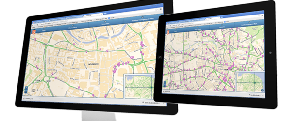
Welcome to FWT's interactive mapping solution.
Cartogold is an intuitive, attractive and professional platform for accessing complex travel and planning information for both corporate and public audiences.
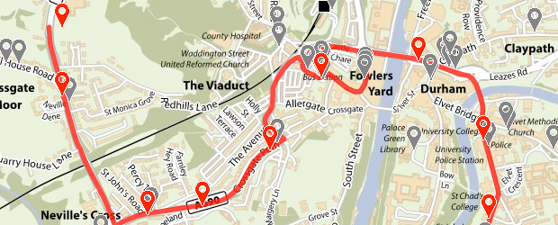
Ordnance Survey based mapping, combined with our specialist skills allows complete flexibility to portray public transport stops, routes and times, both scheduled and real time, and recommended walking and cycling routes.
Our growing number of local government clients also benefit from the systems ability to illustrate colour coded environmental and development zones and related policies, as demonstrated by Wyre Forest District Council.
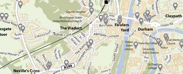
The latest version of our interactive public transport solution for Durham County Council allows users to directly access bus routes and times by highlighting their chosen bus stop. This has been made possible by our development of software compatible with TransXChange timetable and stops data, supplied directly by the client.
The latest generation Cartogold sites are built using HTML5, to ensure compatibility with mobile and tablet devices.
Cartogold is a complete managed solution, from concept to delivery, hosting, account management and future developments.